Letter 12
Tuesday 01.08.11
All goes according to plan. I buy one hour of internet connection 8.30.
At 9.30 I pack the rest and have to say goodbye to Martin and Josefine.
We're sorry to part. There was a mutual instant sympathy. But we
exchange e-mail adresses. I pay and go for the bike repair shop. The
young man isn't really obliging, but he does the best he can and after a
l-o-n-g search with several negative results, he finds a screw that fits
the thread and is with countersink, even it's not identical. Now the rim
is fastened at 4 spots, though it's still broken. What do I owe him for
all the trouble? It was nothing. Costs nothing! I'm quite touched. I
don't find this kind of service anymore at home.
I shop food and find my way back to the cycle track in Bruck. And then
it's just going ahead... Yes, but... The valley is much more narrow than
in Krimml. It's not only the villages I'm sent up through. Up and down
across knolls it goes. Ascends of 6-8% and 2-300 m of length. Much to my
surprise.
Meet with a swiss couple. When they want to show me which route they're
following towards Vienna and I take out the map from the plastic cover,
I put it somewhere on her bicycle or luggage. And when they move on, I'm
suddenly with the map but without the cover. Catch them! They don't
carry much luggage and I would never have caught up with them, but
fortunately the cover has fallen off and I find it and put the map
inside again.
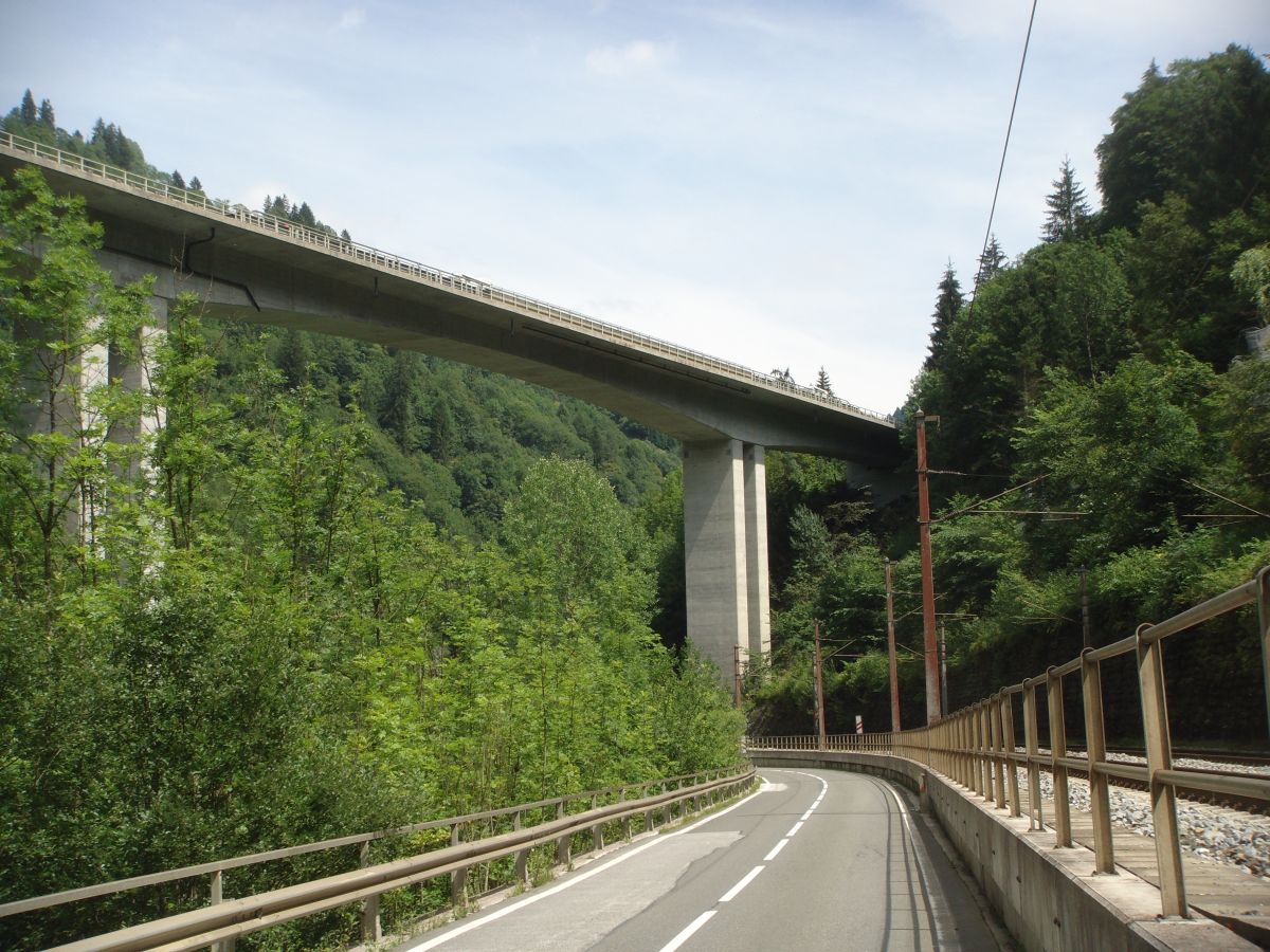
Then the valley gets even more narrow and the cycle track goes in turn
on one side of the main road and the other. Every time the track changes
position and goes under the main road there are warning signs and
mirrors, because it goes steep up and down and there could be oncoming
bikes.
The clou comes when the main road disappears in a tunnel and we follow
the turnings of the old main road on the mountainside through the gorge.
Then it goes down, down, down to the river, while the new main road
disappears on long legs high above us.
Now I'm in Lend eating lunch. It's amazing: in my direction there's no
traffic, in the opposite direction it seems like ALL the cars of the new
main road are coming.
My conclusion is that there's either been an accident or they're working
on the road in one lane.
 |
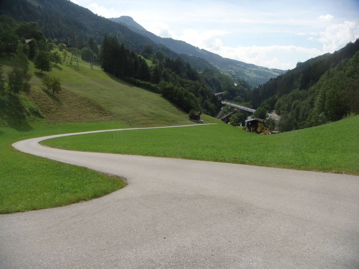 |
| Under the main road | Looking back on the Schwarzach incline |
When the signs urge me to cross under the railway and up the sky, I
refuse and stay on. A little later my thoughts are confirmed: It's a
construction high up on the new concrete road. I think they're widening
it.
Later I have no choice: I have to go up! The worst incline until now. On
the steepest part I stand up and force the pedals down in turn. It's
possible to do it so slowly that I also am able to breathe. 5 km/h. The
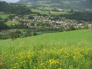
road inclines in further steps. The reward is the view over Schwarzach,
which is situated where the valley widens. Just to get narrow again.
Up again. Downhill all the way to Salzburg? I was pretty naive...
On my way up I happen to stop a cyclist going down. He tells me there's
both a Tauernradweg and a Salzachradweg, that should continue along the
river all the way to Salzburg. It's hard for me to believe... think
there were spots where it impossible could have followed the river, but
I'll look into it. By the way I'm close to one of my "sights".
Lichtensteinklamm, and even better: the road is flat all the way to
Bischofshofen.
 |
 |
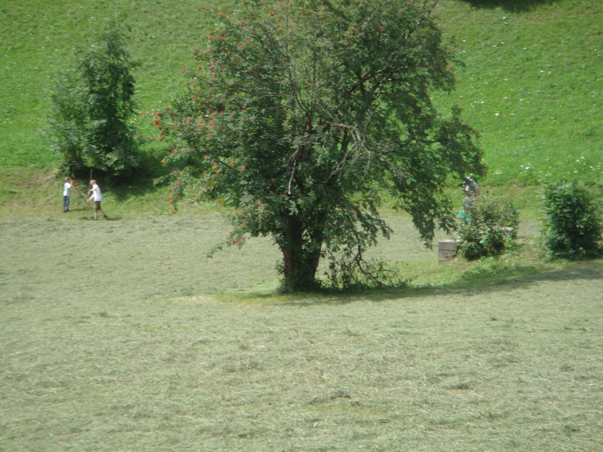
| Collecting the hay | View over Schwarzach |
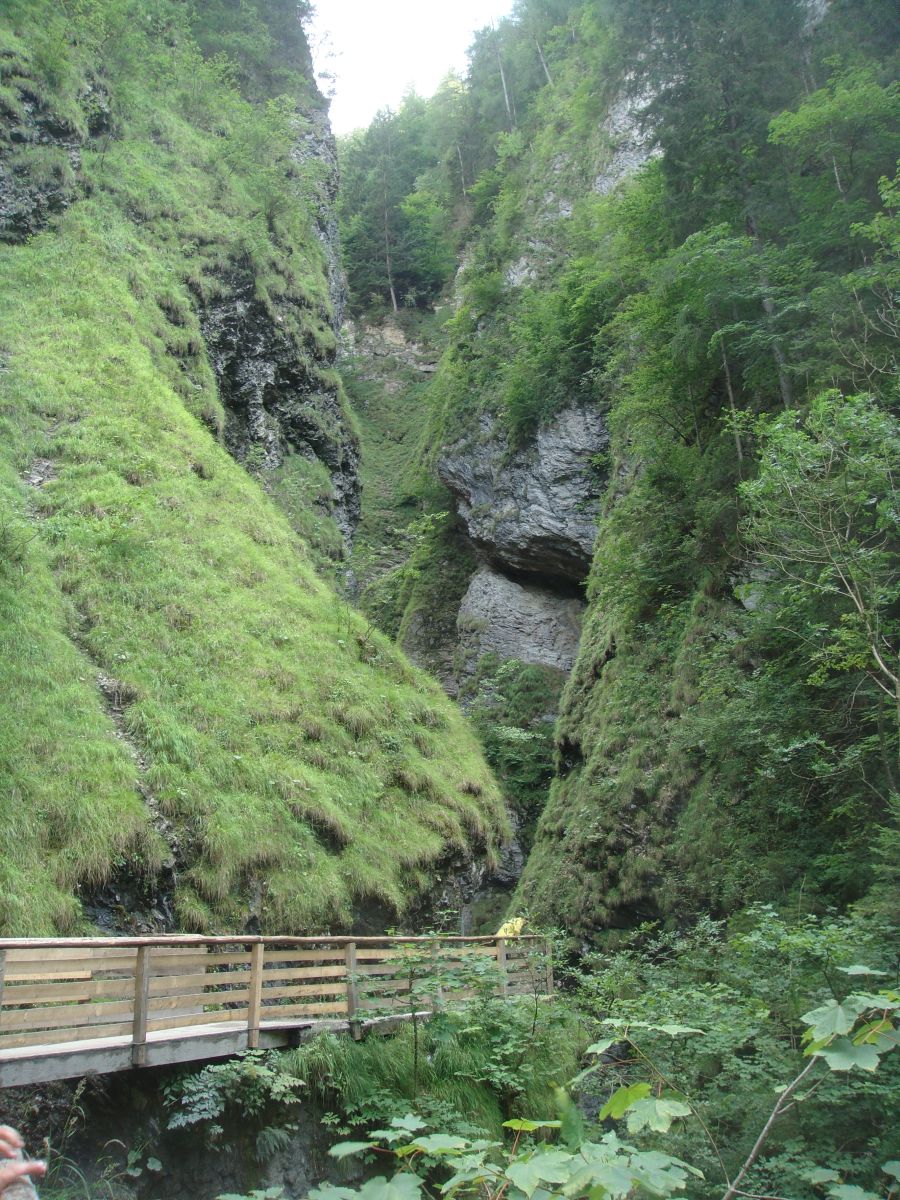
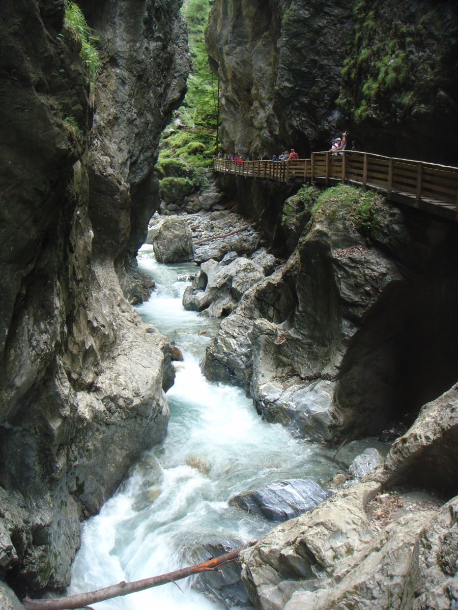
Lichtensteinklamm is worth all the efforts. Rather surprising a gorge
opens in the soft formed mountainside. The water has made it's way
through here during millions of years. One walks and walks on narrow
wooden bridges or on paths cut in the rocks. Through tunnels hewed
through the mountain, all the time accompanied by the roar of the water.
The path ends at the waterfall, where the water drops 20 m to join the
river.
That saved the day.
 |
 |
| Lichtensteinklamm... | ...saved... |
 |
 |
| ...the... | ...day |
A grey wall rise at the end of the valley. At last I get to the river
and follow it towards the wall.
The wall turns up to be Tennengebirge with 4 peaks at about 2400 m. The
river runs west.
Suddenly comes up a sign of camping to the left. I follow and now I'm
all settled and only need to cook my pasta with "schinken".
It's a breathtaking sight to sit here outside the tent on a plastic bag
(a tiny chair would be a progress) watching the wall with all it's peaks
where the sun is still shining, now shadows long has covered the site.
Which is next to the river. Unfortunately it's like this in valleys:
things are pressed together. The railway runs just the other side of the
river - and it's not noiseless...
64.4 km
14.7 km/h
46.3 km/h
4:21:23 h